Diagrams, illustrations, and maps showing the geology and natural history of the Thousand Islands area of the St. Lawrence River designed and created for panels in Wellesley Island State Park’s Minna Anthony Nature Center.
Read more about the renovated Nature Center here:
https://parks.ny.gov/newsroom/press-releases/release.aspx?r=1432
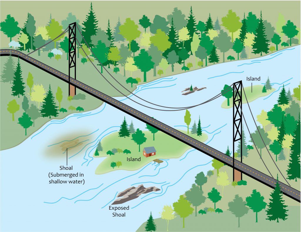
Diagram showing parts of a river
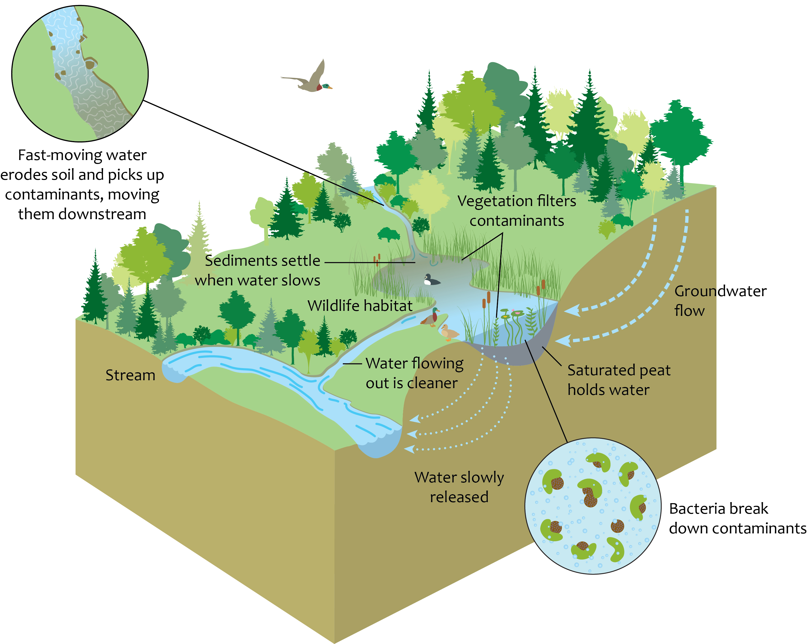
How wetlands function to clean water and regulate its flow
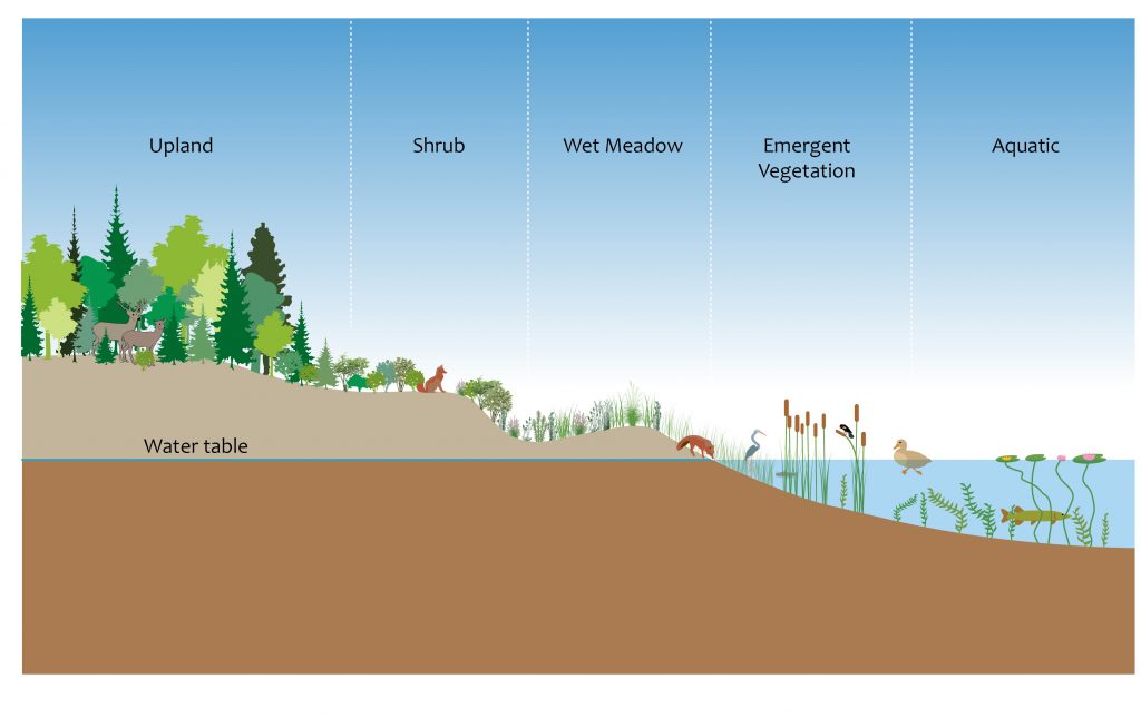
Cross-section showing wetland zones
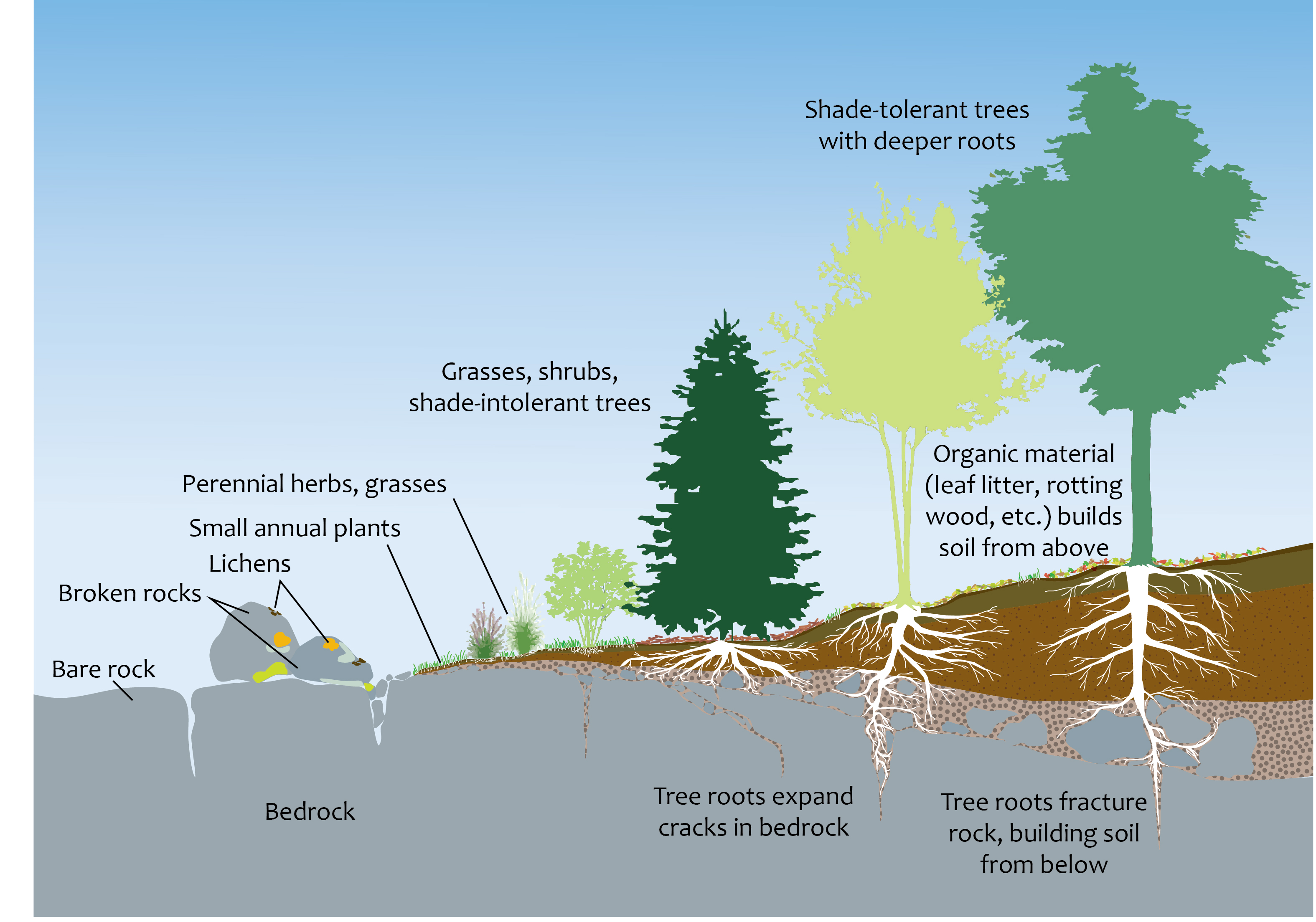
Diagram showing how lichens, small plants, and tree roots work to form soil by breaking up bedrock and adding organic material
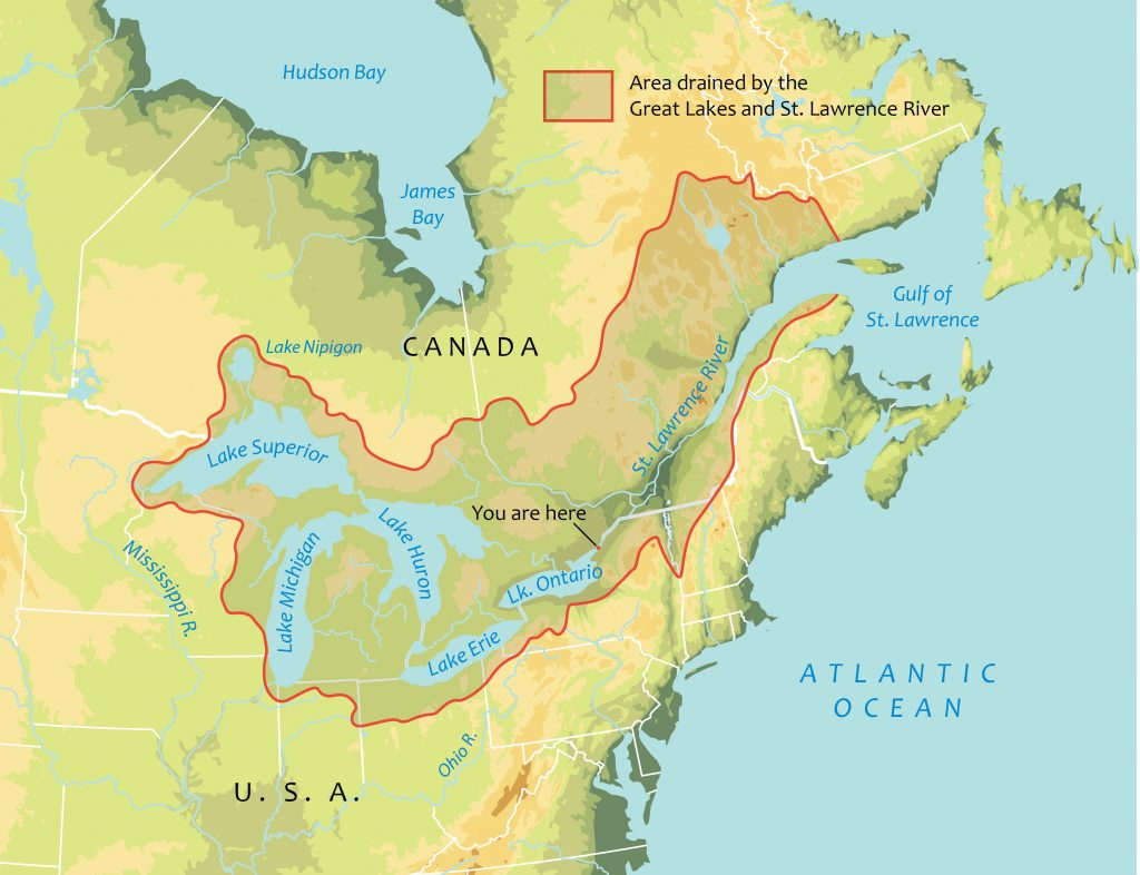
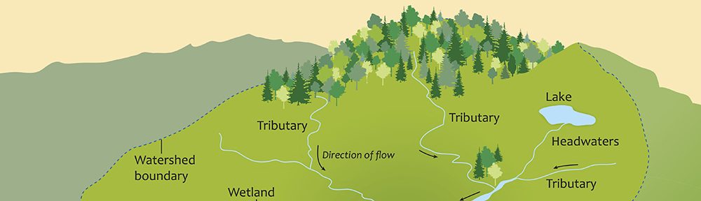
Map of the Great Lakes-St Lawrence watershed