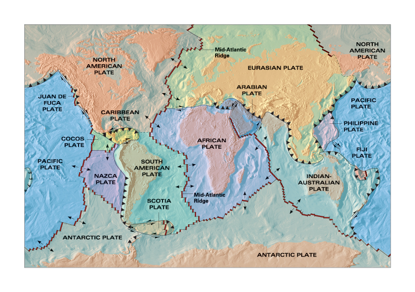
Plate Tectonics map with shaded relief for college text, created back in the 1990s. It has stood the test of time; it is used in geologist Nick Zentner’s popular online geology lessons. © Prentice Hall
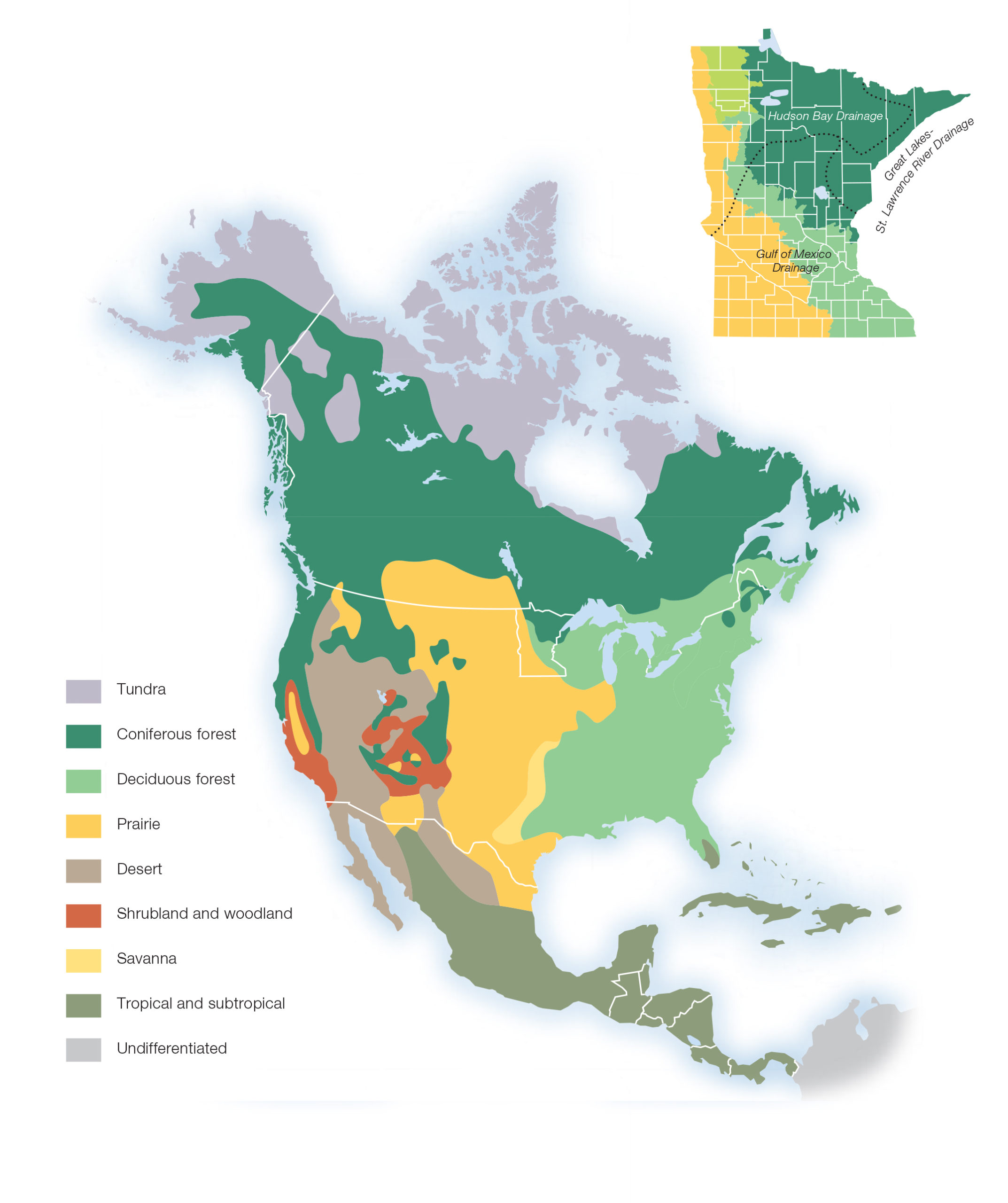
Biomes of North America from MInnesota’s Natural Heritage, second edition, published by University of Minnesota Press ©2021. Image was restyled from the original created for the first edition in 1993.
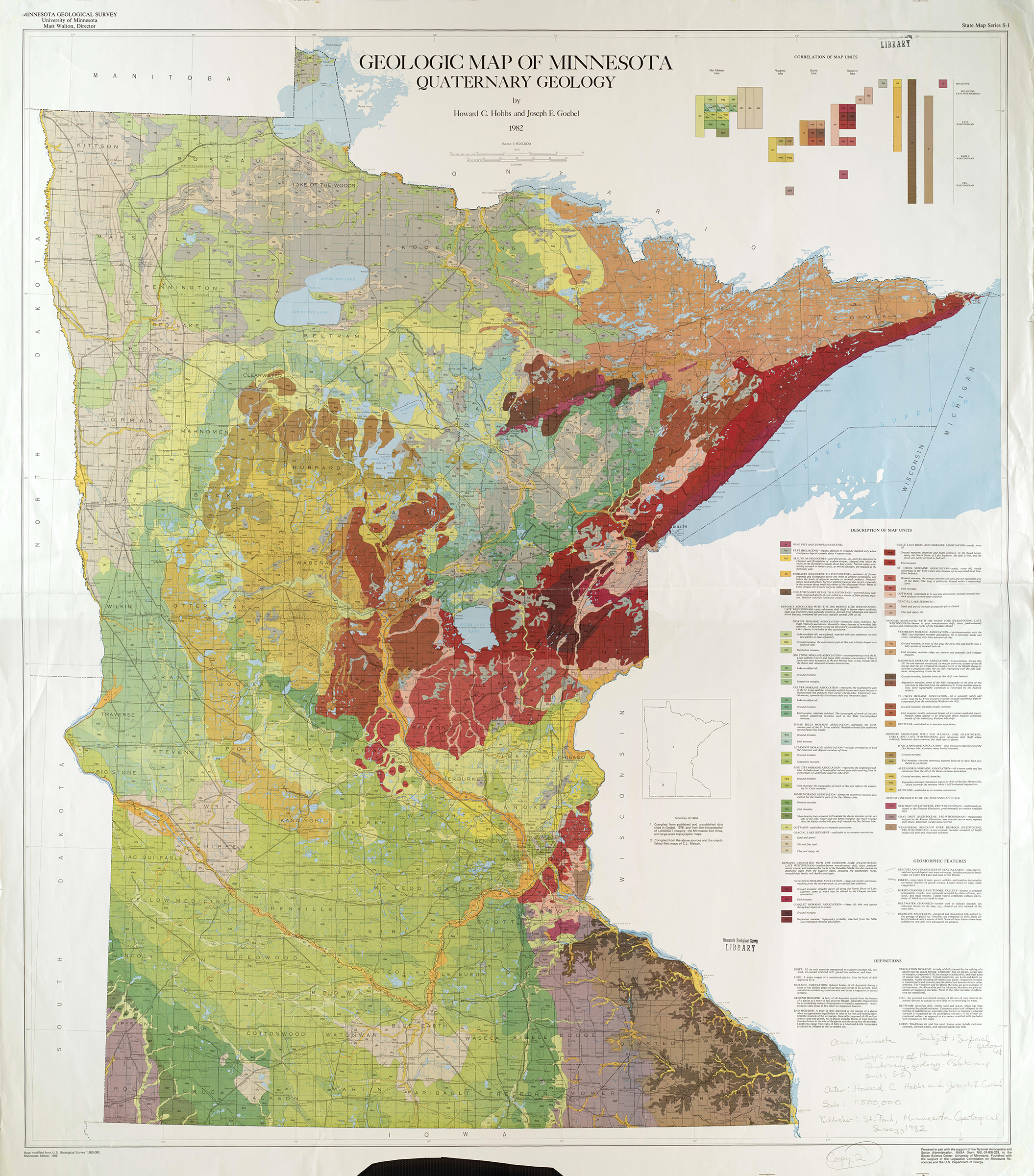
Quaternary Geologic Map of MN
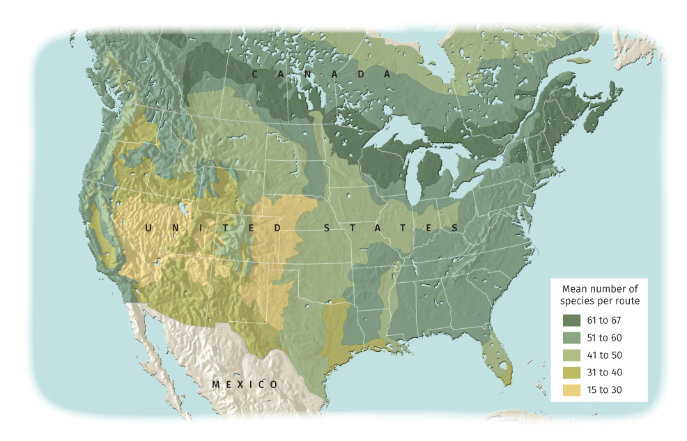
Map showing diversity of bird species for North Shore: A Natural History of Minnesota’s Superior Coast © University of Minnesota Press
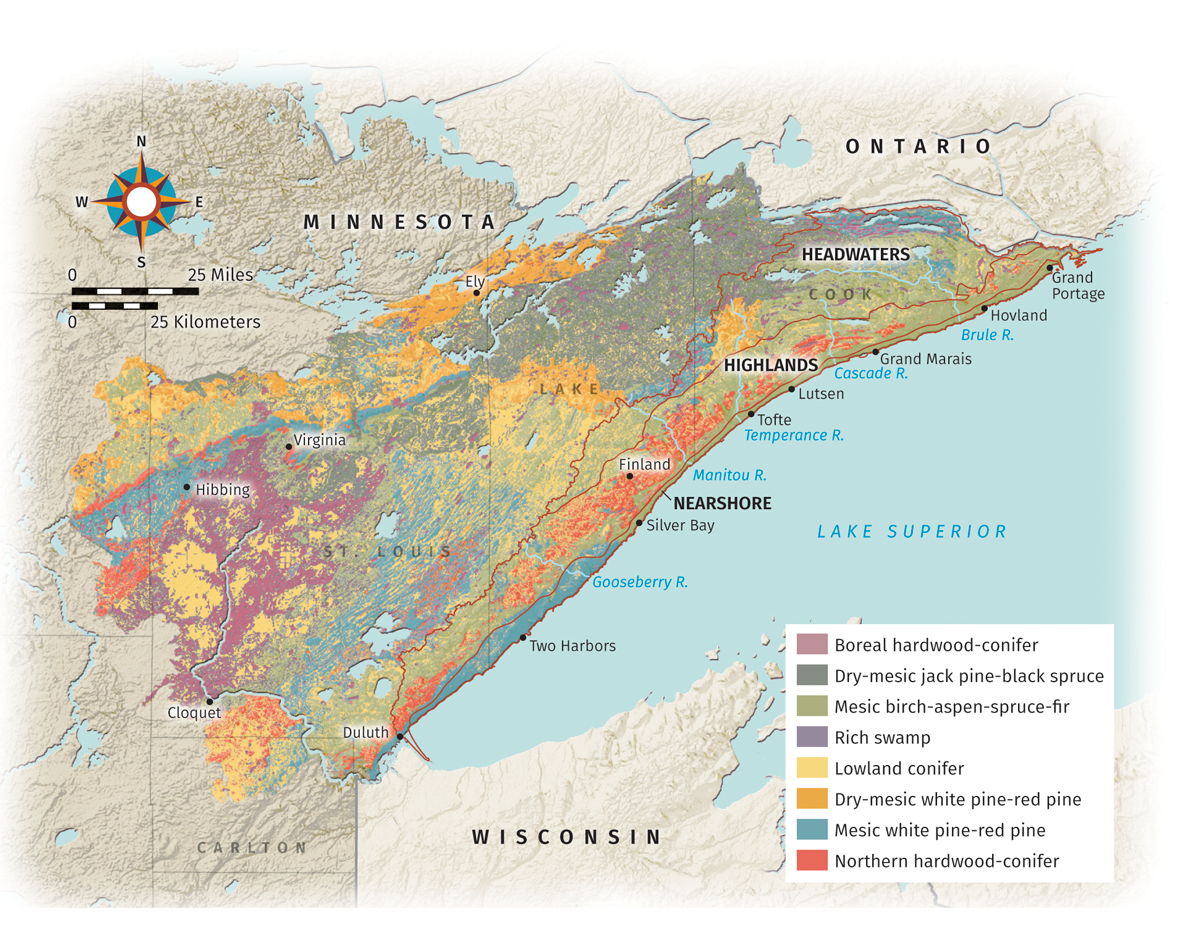
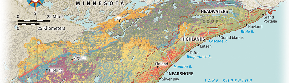
Map of northeastern Minnesota vegetation, generated using GIS data, for North Shore book. © University of Minnesota Press.
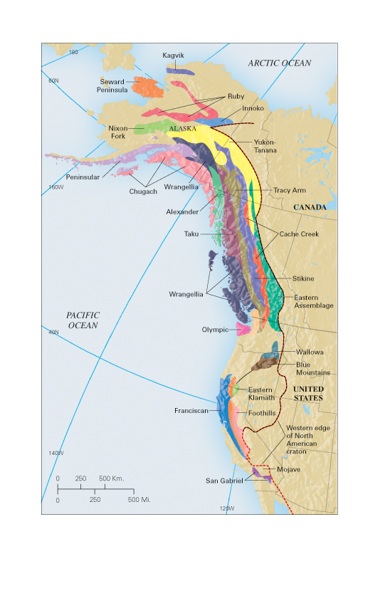
Geologic map of Western North America with shaded relief. © Prentice Hall.
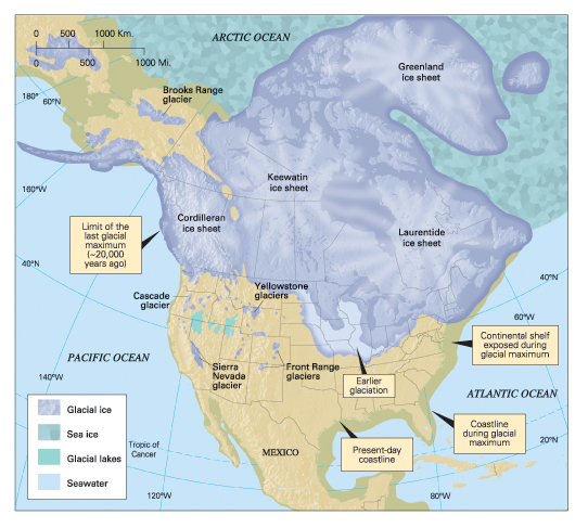
Map of Glaciation in North America. © Prentice Hall.
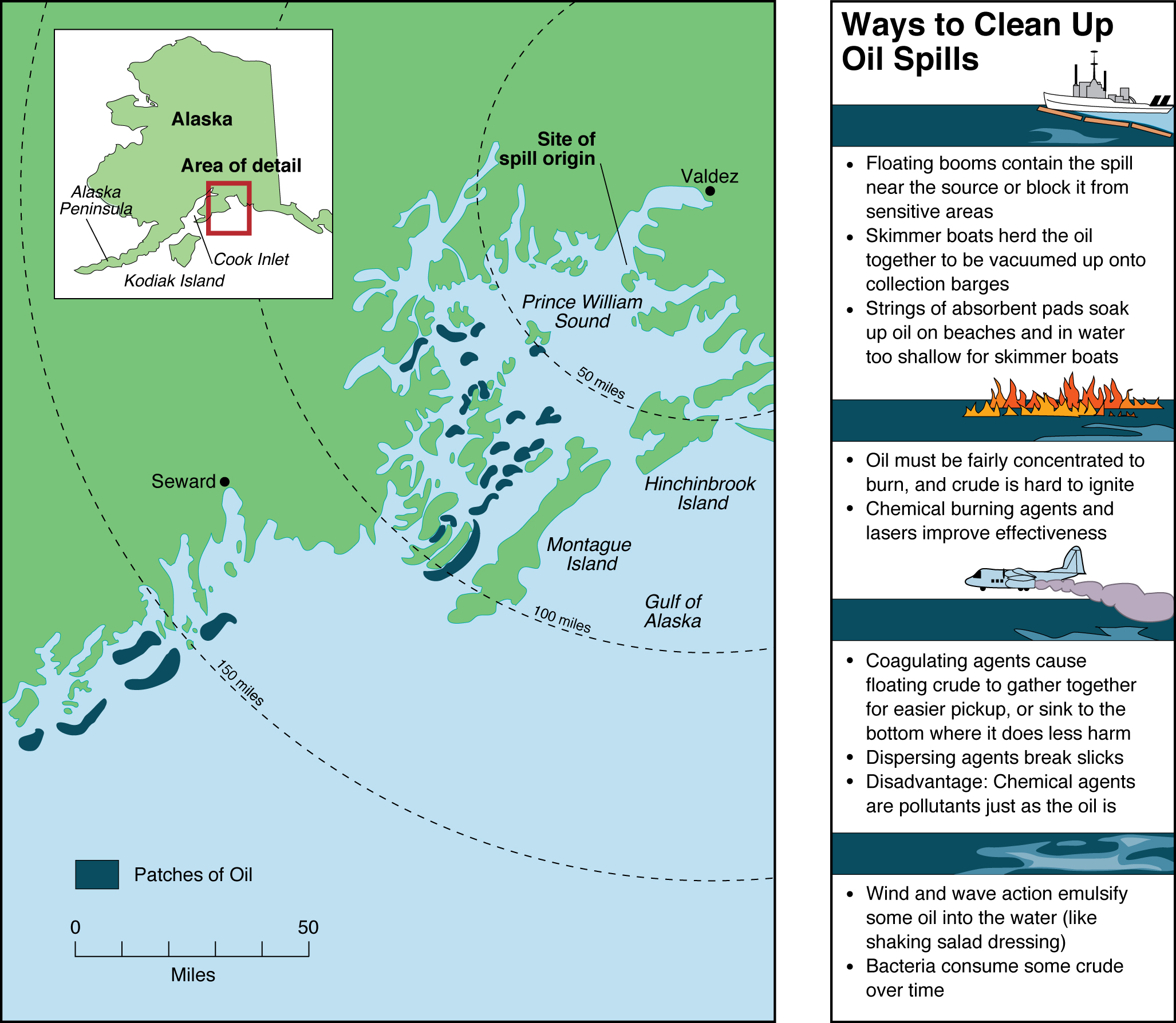
Map of Alaska oil spill with sidebar © Wm C Brown Publishers
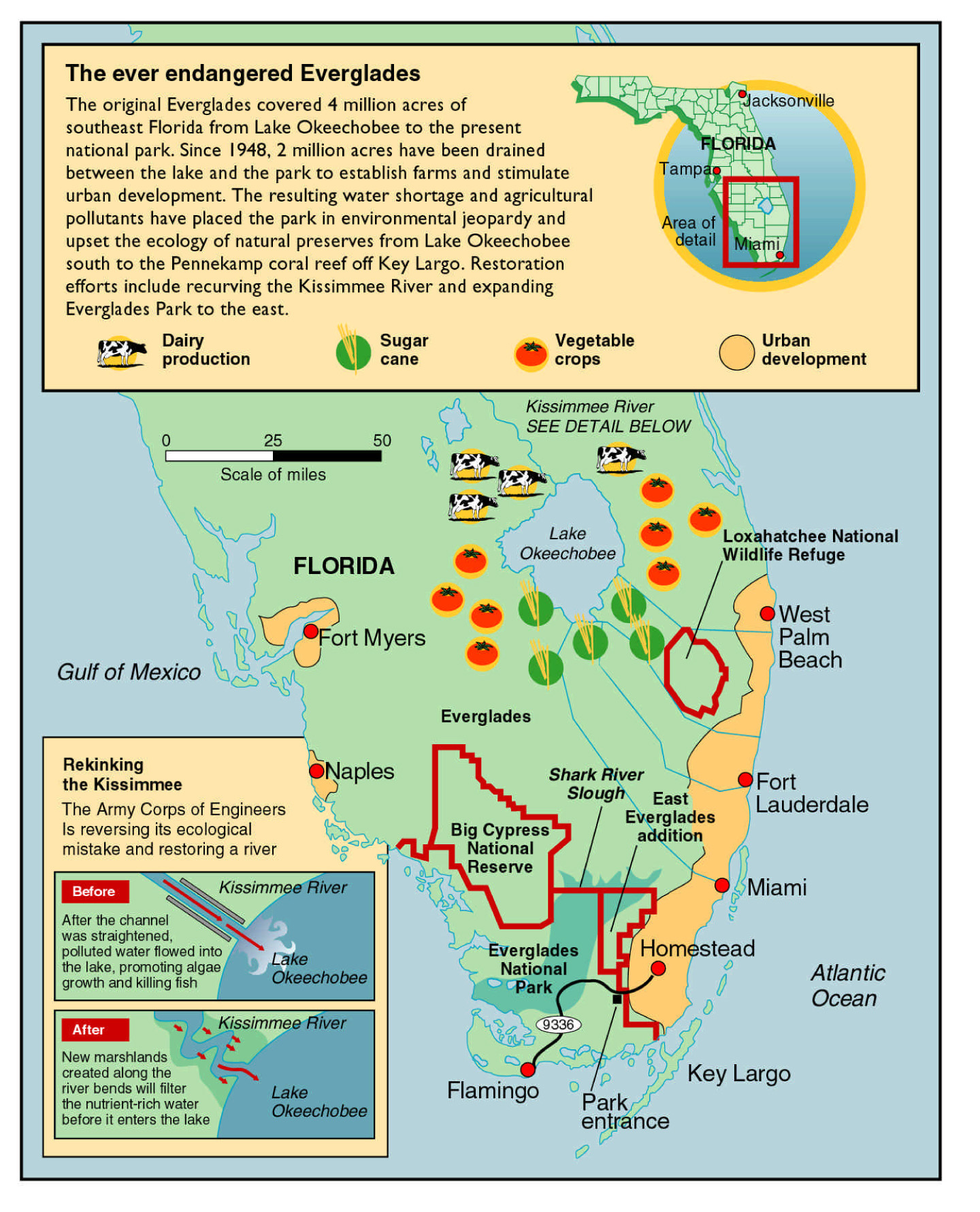
Map/infographic explaining the role of the Kissimmee River in protecting Lake Okeechobee water quality.
Area of ash cloud from volcanic eruption. © Prentice Hall.
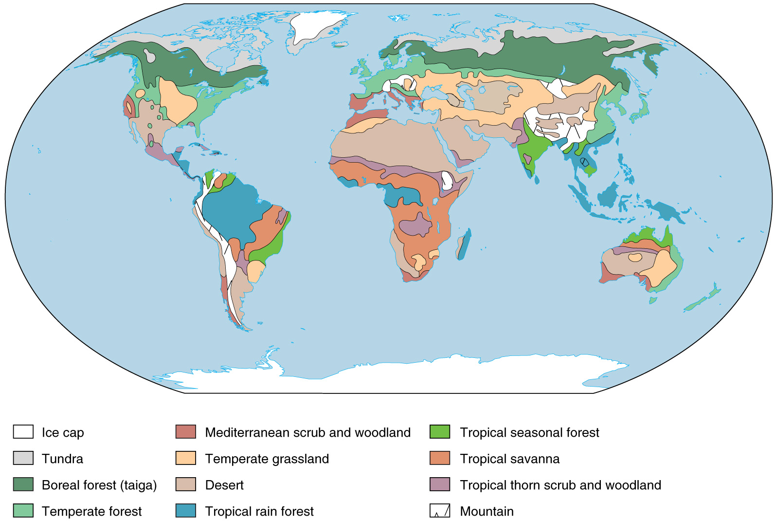
Map of world biomes for environmental studies textbook. © Wm C Brown Publishers.
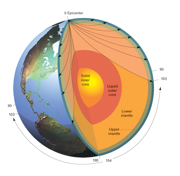
Cutaway globe showing movement of seismic waves. © Prentice Hall.
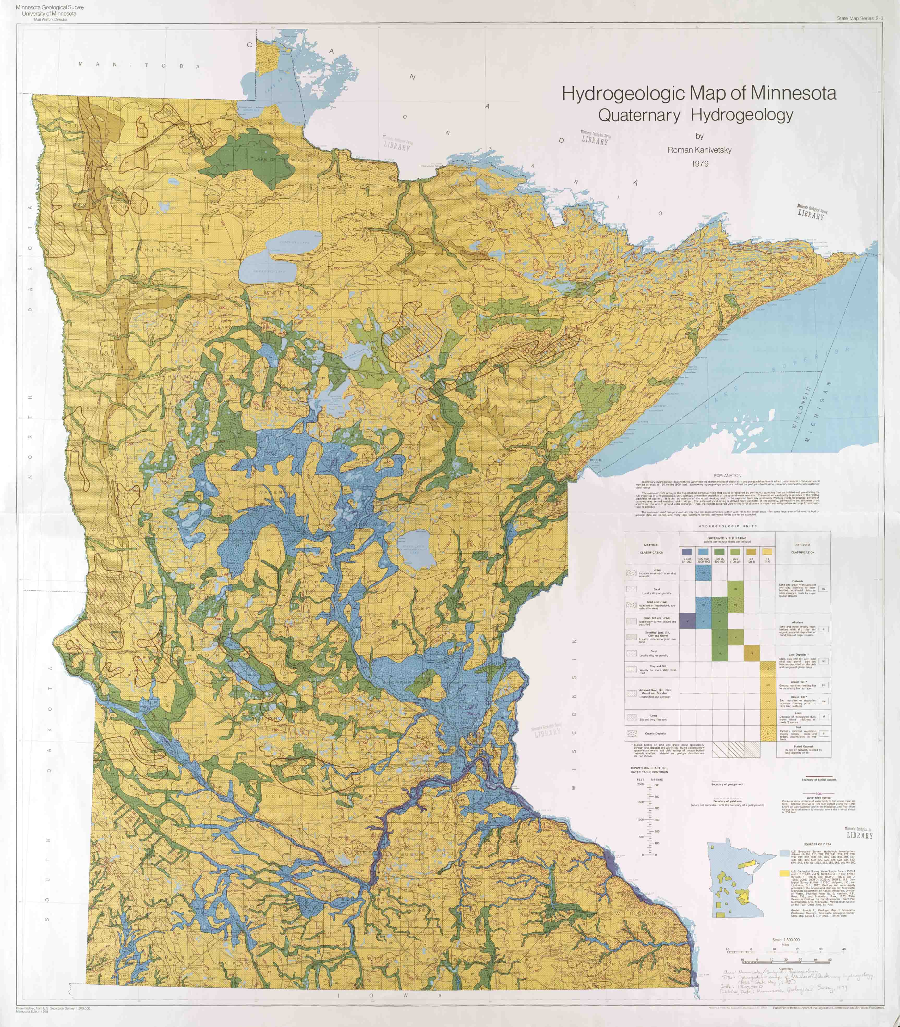
Scan of 4′ x 5′ map of Quaternary Hydrogeology designed and produced for Minnesota Geological Survey
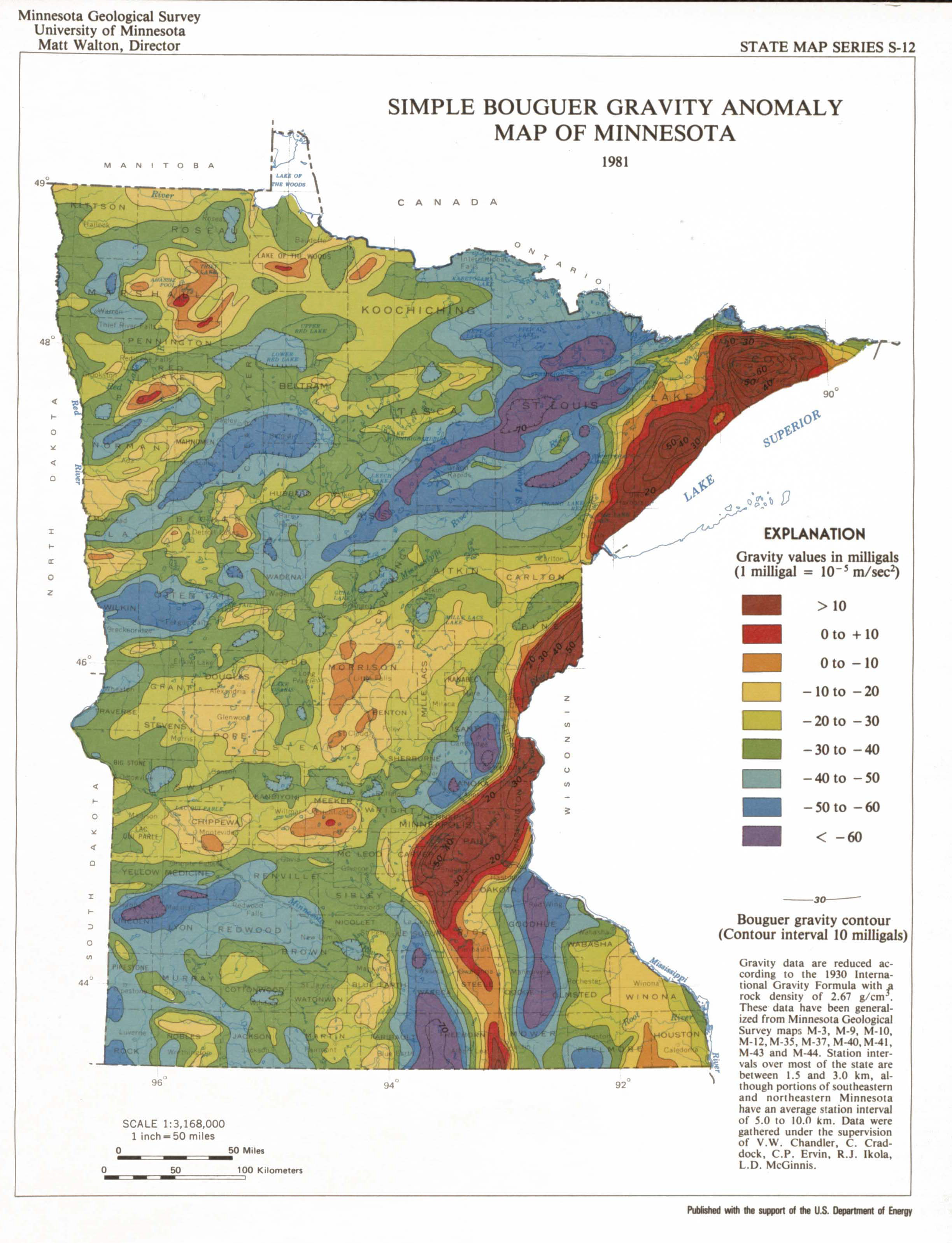
Scan of page size Simple Bouguer Gravity Anomaly map designed and produced for Minnesota Geological Survey
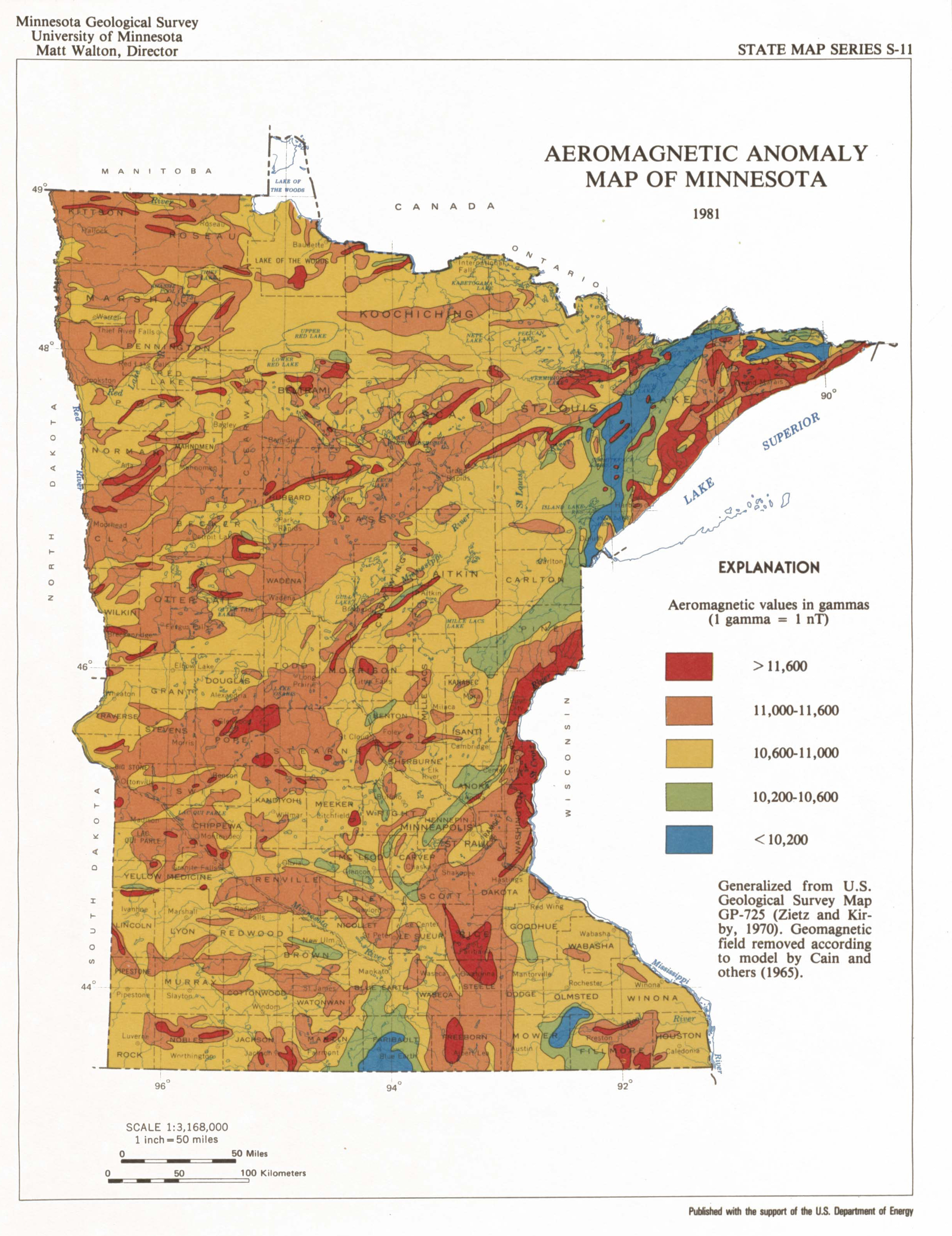
Scan of page size Aeromagnetic Anomaly map designed and produced for Minnesota Geological Survey